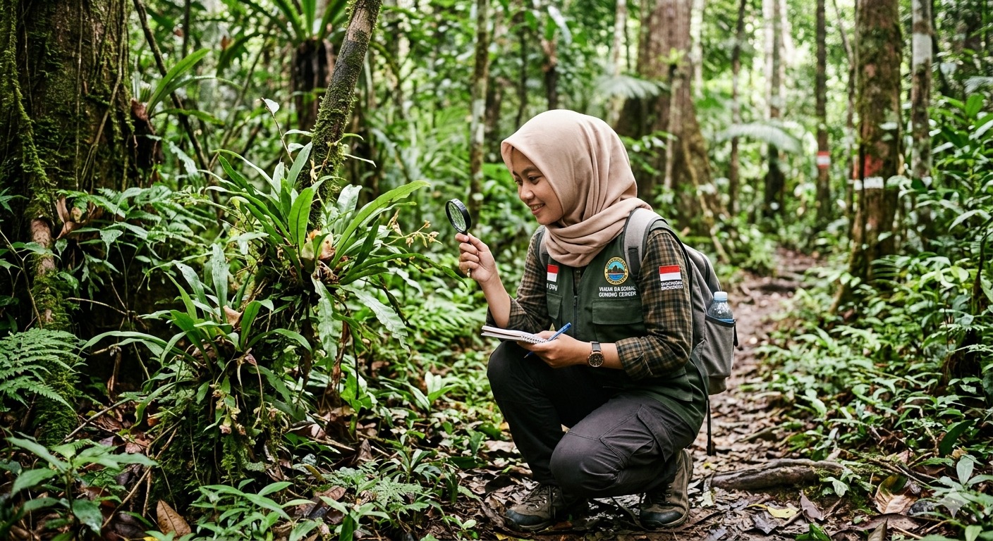
At 2:14 in the morning on a Tuesday in March, a sensor station on the eastern edge of the Leuser buffer zone detected a sound. The station's onboard processor, running a classification algorithm trained on thousands of hours of forest audio, flagged it within seconds: chainsaw. The coordinates were logged, a timestamp was recorded, and an alert was sent via the cellular network to the duty phone of the nearest ranger team.
By 4:30 AM, two rangers were on site. They found fresh cut stumps — three trees, large-diameter, valuable timber species — and evidence of a recently departed vehicle. The loggers were gone, but the location was documented, reported to the forest police, and added to the spatial database that now covers 340 square kilometres of Leuser's buffer zone.
This is what acoustic monitoring looks like in practice. And it is changing the way Yayasan KEL — and conservation science more broadly — understands what is happening inside a forest.
Why Sound?
A tropical rainforest is acoustically extraordinary. At any moment, it contains hundreds of overlapping sound sources: birds, insects, mammals, wind, rain, running water. This complexity, which makes the forest difficult to listen to with untrained ears, is precisely what makes it scientifically valuable. The soundscape of a healthy forest is structurally different from the soundscape of a degraded one — measurably, quantifiably different.
Ecoacoustics — the study of the relationship between ecosystems and their acoustic environments — has emerged over the past two decades as a powerful tool for biodiversity assessment. Indices derived from sound recordings, such as the Acoustic Complexity Index (ACI) and the Bioacoustic Index (BI), can correlate with measures of species diversity obtained through traditional survey methods, but at a fraction of the cost and with continuous rather than point-in-time coverage.
For Yayasan KEL, the practical appeal of acoustic monitoring is straightforward: we cannot have rangers everywhere at all times. But we can have microphones. A network of low-cost, solar-powered acoustic sensors can cover an area that would require dozens of full-time rangers to patrol by foot — and it listens continuously, in the dark, in the rain, during the hours when illegal activity is most likely to occur.
Building the Network
Our sensor network began in early 2026 with a pilot deployment of eight stations in the most heavily threatened section of the buffer zone. Each station consists of a weatherproof housing containing a directional microphone, a microprocessor running our detection algorithms, a cellular modem, and a solar panel with battery storage sufficient for five days of cloud cover.
The deployment locations were selected using a combination of spatial threat modelling — identifying areas with the highest historical rates of encroachment and timber extraction — and wildlife habitat mapping, prioritising areas where camera trap data indicated regular use by target species. The goal was not to cover the entire buffer zone uniformly, but to concentrate sensor coverage where both threat and wildlife value were highest.
By April 2026, 27 stations are operational, covering approximately 340 km² of buffer zone with overlapping acoustic detection radii. Three additional stations are in preparation for deployment in the highland core zone, where rhinoceros activity has been previously documented.
What the Sensors Detect
Our classification system is currently trained to detect and distinguish five target sound classes: chainsaw (primary illegal logging indicator), gunshot (poaching indicator), motor vehicle in off-road conditions (encroachment indicator), orangutan long call, and Asian elephant rumble. Each class has its own detection threshold and confidence scoring, and each triggers a different alert protocol.
Chainsaw and gunshot detections above 80% confidence trigger immediate ranger alerts via SMS and app notification. Vehicle detections trigger lower-priority alerts for follow-up review during daylight hours. Orangutan and elephant vocalisation detections are logged to the biodiversity database without generating ranger alerts — they are science, not emergency response.
In the first three months of full network operation, the system generated 847 audio events of interest. Of these, 312 were confirmed as wildlife vocalisations upon manual review — including 47 orangutan long calls, 23 elephant contact rumbles, and, most remarkably, 4 events classified with moderate confidence as consistent with Sumatran rhinoceros vocalisation patterns. These four events, clustered in a 12-day period in the highland core, are currently under review by rhinoceros specialists. If confirmed, they would represent the first documented evidence of rhinoceros presence in this section of Leuser in more than a decade.
The Limits of Listening
Acoustic monitoring is a powerful tool, but it is not a complete solution. Sound classification algorithms produce false positives — motorcycles misidentified as chainsaws, large falling branches triggering gunshot detections, wind noise corrupting recordings during storms. Manual review by trained analysts is essential, and it takes time. Our current review backlog is approximately 72 hours, meaning that non-urgent events from three days ago are only being reviewed today.
There is also the fundamental limitation that acoustic detection requires the production of sound. A skilled poacher moves quietly. A small-scale encroachment — a few trees cleared with hand tools, a garden established gradually at the forest edge — may not produce the acoustic signature that triggers our algorithms. The network is highly effective at detecting mechanised activity. It is less effective at detecting patient, careful, manual encroachment of the kind that is, in many ways, the most difficult to address.
This is why we treat acoustic monitoring as one layer of a multi-layered surveillance and response system, not as a replacement for ranger patrols, community engagement, and the social relationships that remain the most reliable source of intelligence about what is happening at the forest edge.
Data as a Public Good
All biodiversity detection data from our acoustic network — wildlife vocalisations, species occurrence records, detection coordinates — is shared with the national biodiversity database (BRIN/LIPI) and with the Leuser Conservation Forum. We believe that data collected in a public forest with public and donor funding should be a public asset, available to researchers, policymakers, and other conservation organisations working in the same landscape.
The threat detection data — chainsaw events, encroachment incidents — is shared in aggregated, de-identified form with relevant government agencies. Individual incident coordinates are provided to law enforcement through official channels in coordination with our legal team.
At 2:14 AM on a Tuesday, a microphone in the forest heard something it was not supposed to hear. By dawn, rangers were on site. The trees were already gone — but the evidence was preserved, the location was documented, and the pattern was added to a growing dataset that is helping us understand where, when, and how the forest is being threatened. That is what listening to the forest means in 2026.

Recent Posts
The Last Four: Living with Sumatra's Megafauna
April 22, 2026
Reforestation From the Ground Up: What It Actually Takes
April 22, 2026